Geographer - Urban Planner
Innovate with EU Space Data is an EU-funded programme implemented by Expertise France under the Global Gateway strategy, supporting startups and SMEs worldwide in integrating Copernicus space data.
As an expert mentor on the Philippines and Caribbean programmes, supported selected innovators and companies in leveraging Earth Observation data for projects in climate resilience, energy, agriculture and environmental monitoring.
Training sessions, applied research and tailored technical advisory.
One of the mentored companies was able to present their work and collaborate with the Philippine Space Agency.
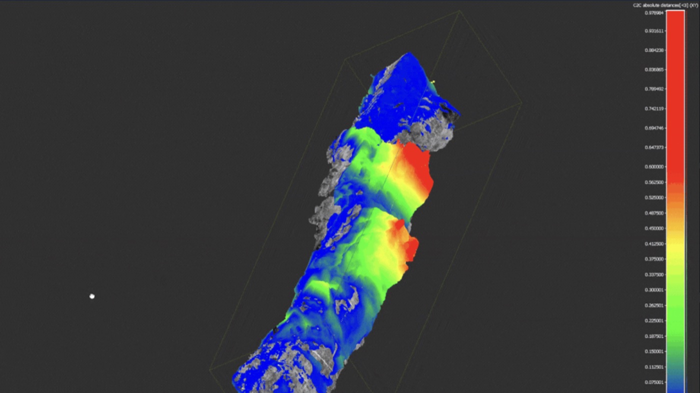
Stratafy is a South African company specialising in seismic and geotechnical technologies for the mining industry, combining sensors, real-time data processing and predictive analytics.
Developing a geological discontinuity analysis tool on 3D point clouds from drone surveys. Automatic detection of planar surfaces in rock, calculation of geological orientations and classification into discontinuity families for interactive 3D web visualisation.
Full end-to-end integration, from the data processing pipeline to the user interface.
Recreating algorithms from leading industry software directly within the platform, enabling teams to navigate 3D photogrammetric models and compare rock structures before and after each blast. By natively integrating these analytical capabilities, teams can now identify risk zones and better anticipate accidents, without relying on third-party software.
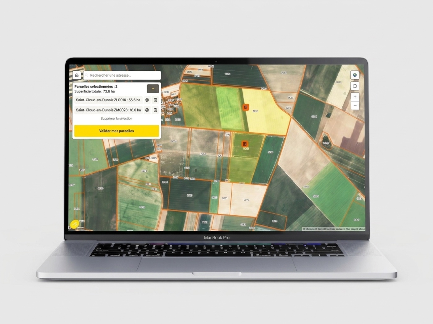
Ferme Solaire is a company specialising in ground-mounted photovoltaic project development, supporting landowners in unlocking the value of their land through solar energy.
Development of two complementary mapping tools. The first is a public interactive map allowing landowners to identify the solar potential of their cadastral plots. The interface is built on Mapbox and cadastral data to deliver a simple and readable experience.
The second is an internal project analysis application, organised around 12 themes (urban planning, environment, risks, grid connection, etc.), centralising all the criteria needed to assess the relevance of a plot. The application queries APIs and geographic databases to automate this analysis.
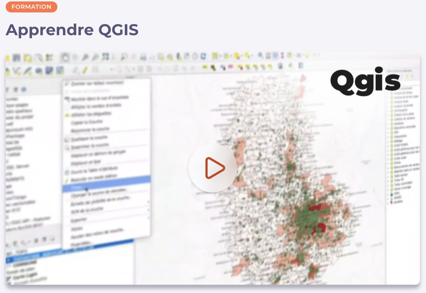
Elephorm is a French online learning platform specialising in creative, technical and professional software training.
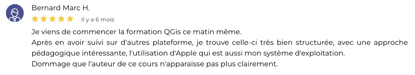
Design and recording of the "Learn QGIS" course available on the platform, a comprehensive training in 41 videos aimed at beginners looking to get started with the leading open source GIS software.
The course covers the full cartographic workflow and targets professionals in urban planning, environment and territorial development, as well as students and researchers in geography and GIS.
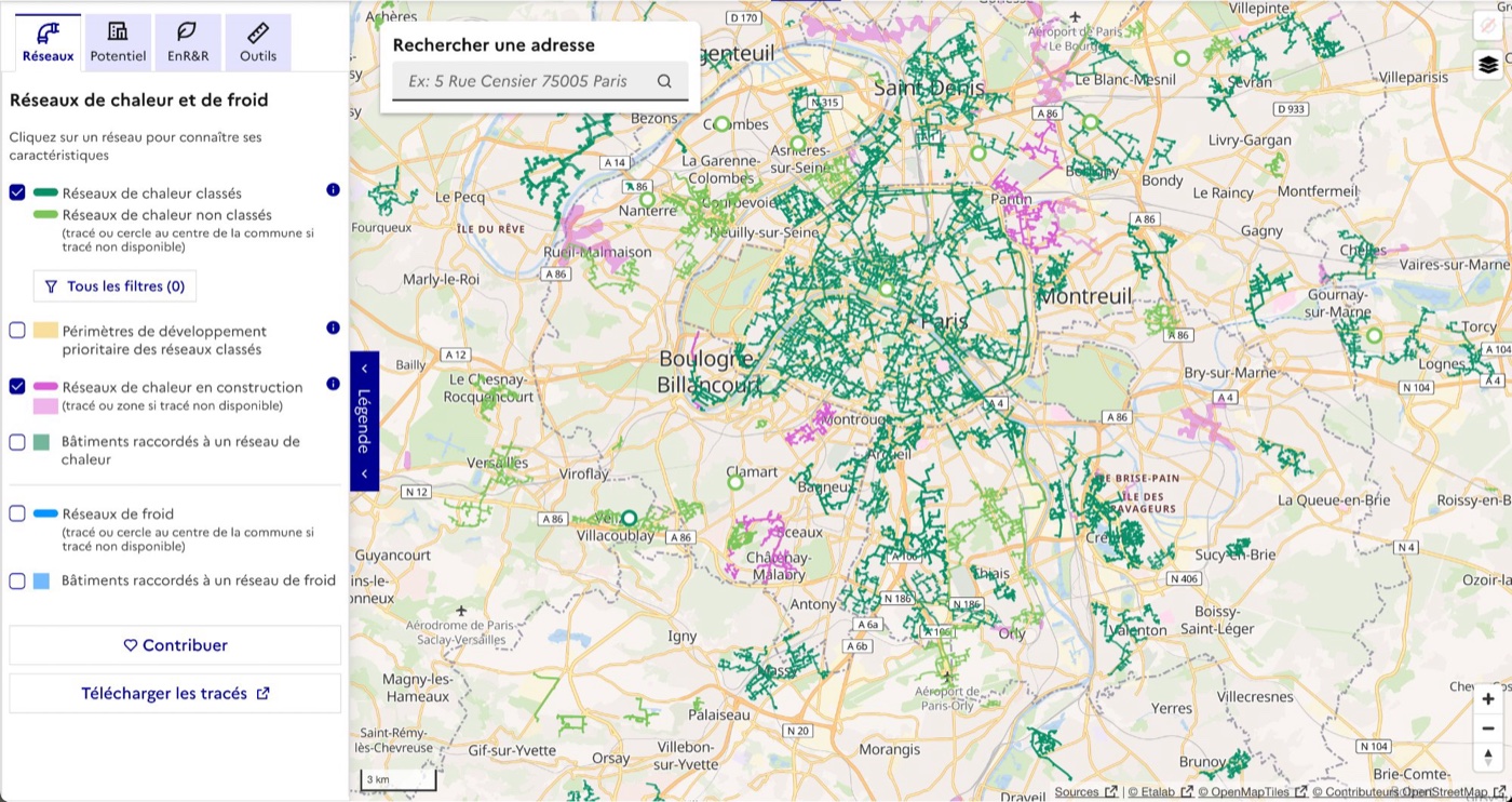
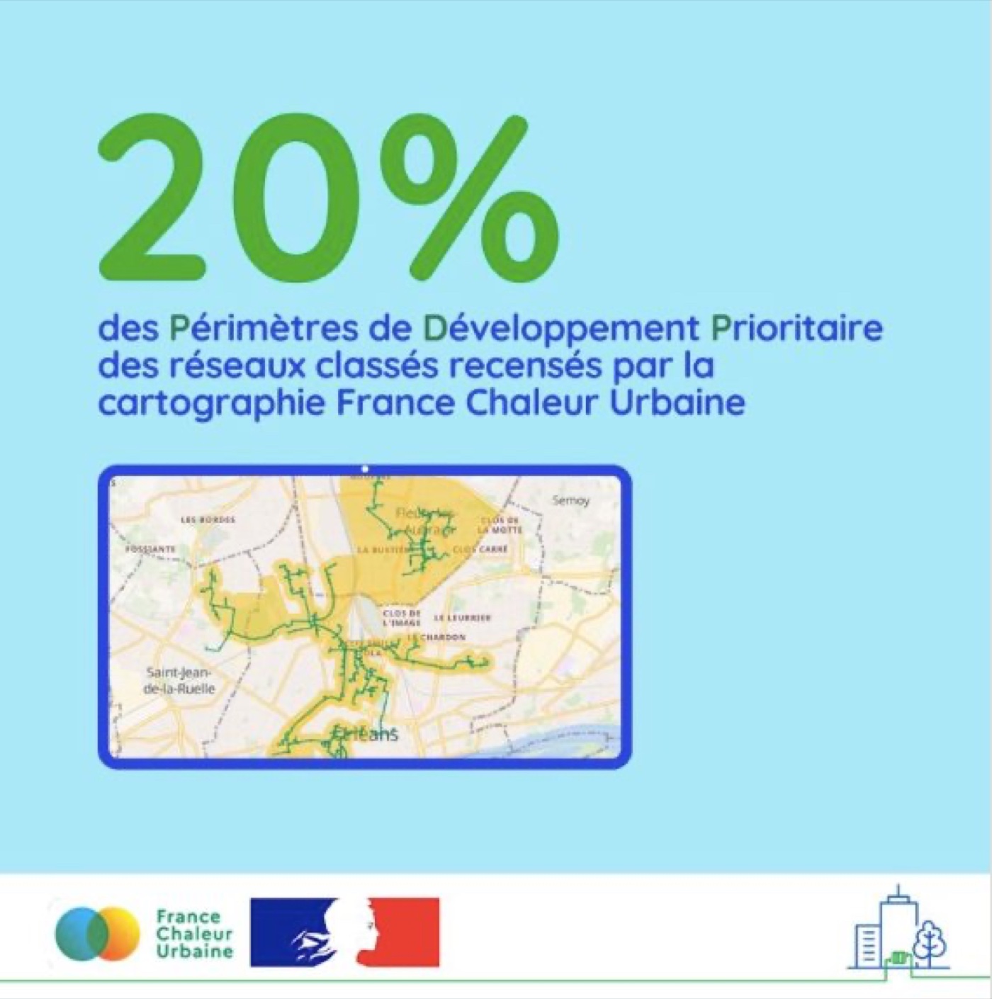
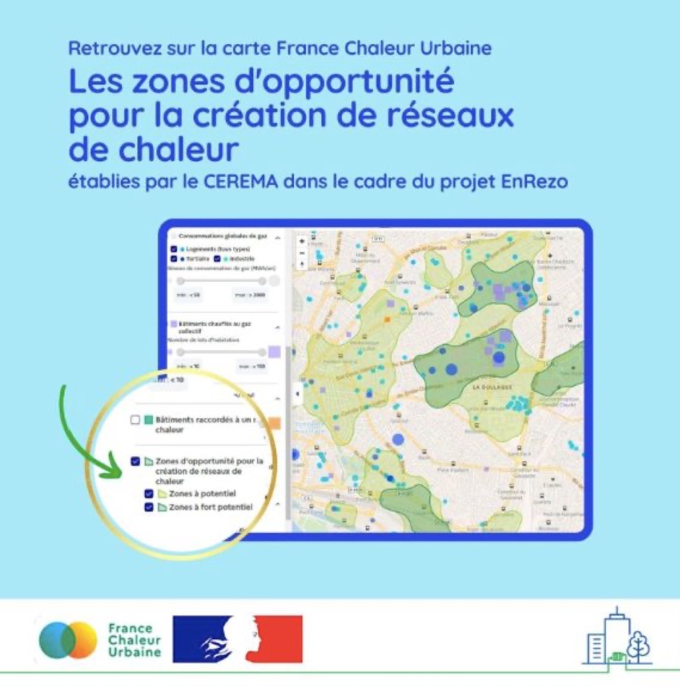
France Chaleur Urbaine is a public service by Beta.gouv.fr that facilitates connections to district heating and cooling networks across France. Named a national impact digital service in 2024, the platform is now the reference mapping tool in the sector, covering 93% of annual heat deliveries in France.
Network data production: priority development perimeters, potential future network zones.
Geocoding and georeferencing of plans and databases, spatial data analysis (buildings, energy infrastructures).
Structuring within a PostgreSQL/PostGIS database and automation of processes to keep data up to date. The open data layer of network routes, built from scratch and released in September 2023, has become the sector's reference dataset.
ADEME supports economic and institutional stakeholders in the ecological and energy transition in France.
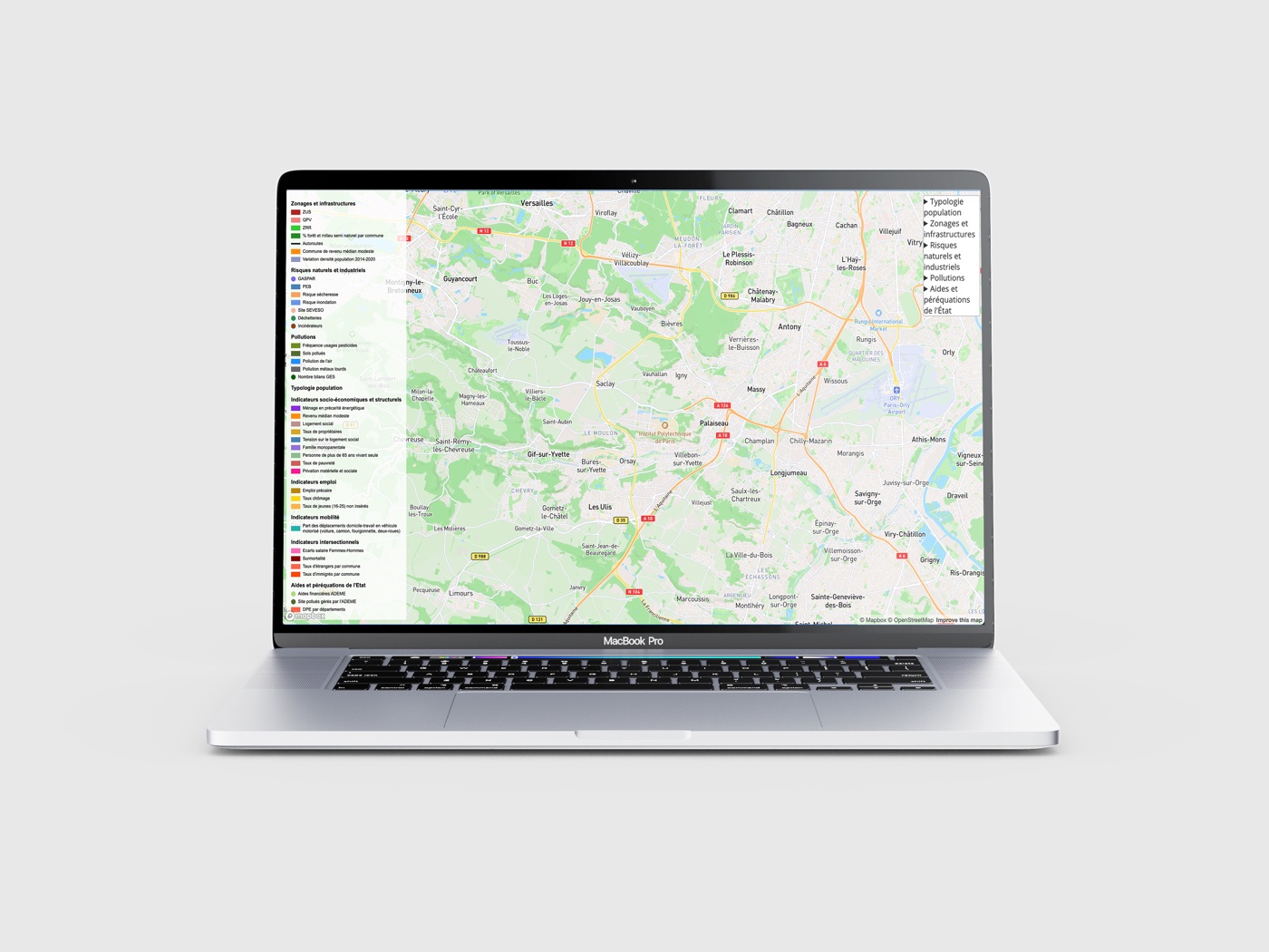
The TEDI study aims to assess whether the ecological transition widens certain inequalities rather than reducing them.
Analysis and cross-referencing of socio-economic, demographic, environmental and risk data at IRIS level, to identify territorial patterns that would not naturally have been connected. Results were delivered through a multi-thematic interactive map.
Coop'HLM is a network of social housing cooperatives in France, committed to building and managing affordable social housing.
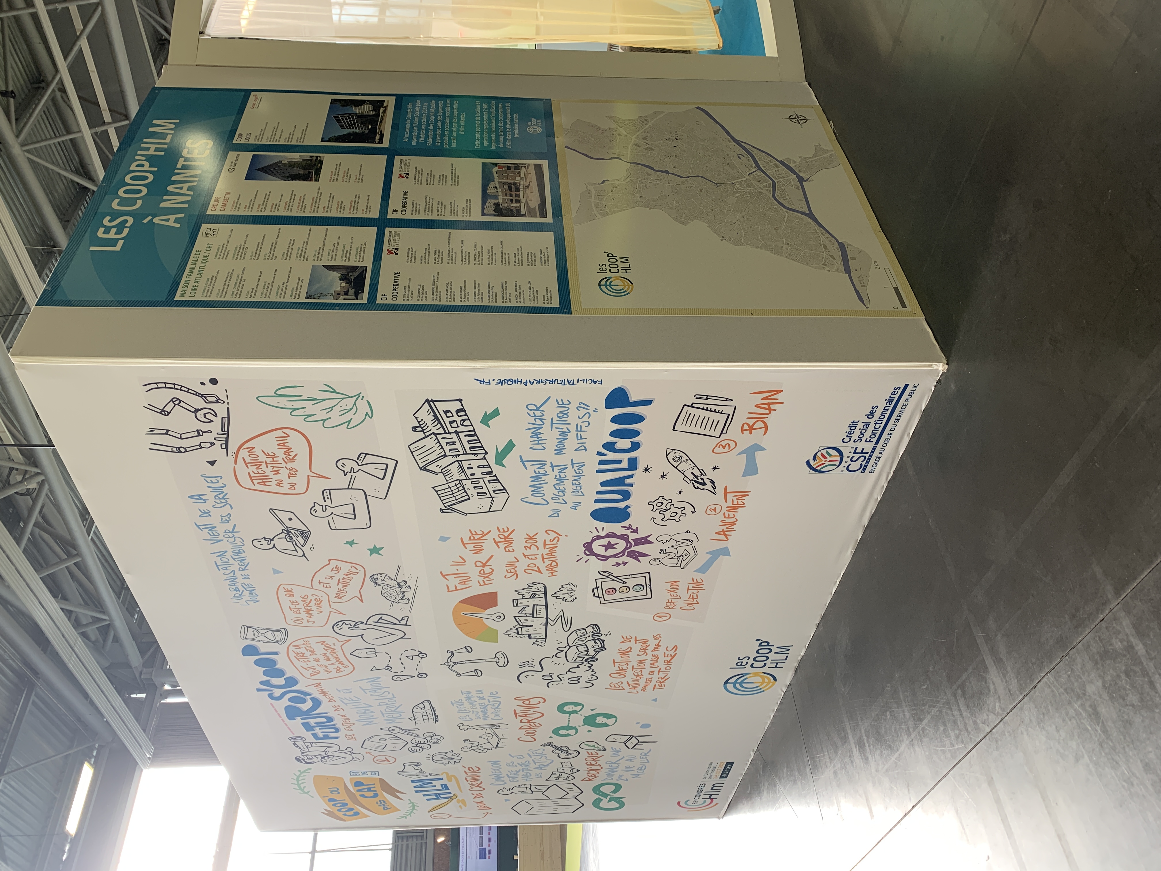
Maps created for the Fédération des Coop'HLM, showcasing social housing programmes in Nantes. Designed to be printed and distributed at the Social Housing Congress.

Comexposium is one of the world's leading event organisers, bringing together 48,000 exhibitors and 3.5 million visitors each year.
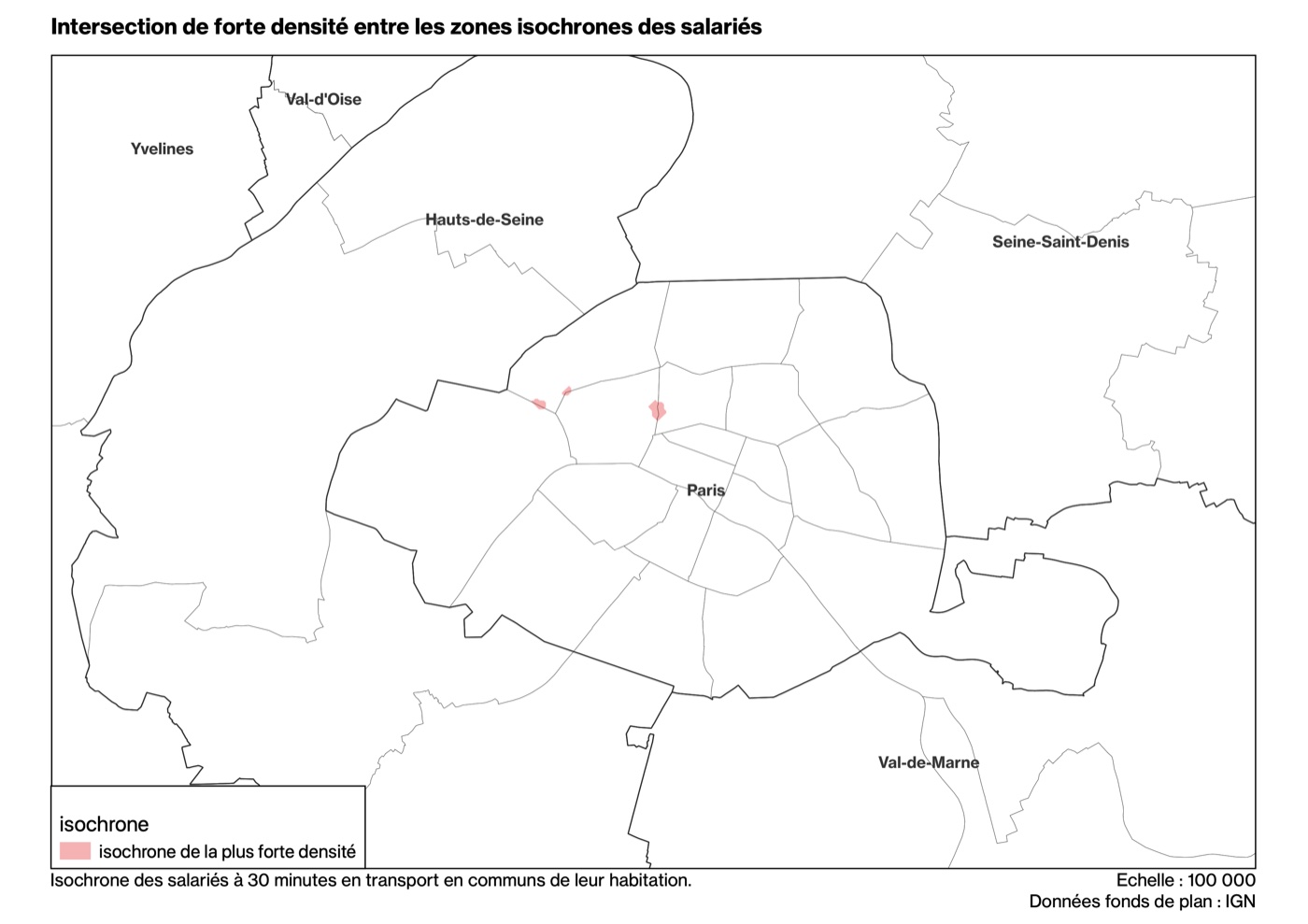
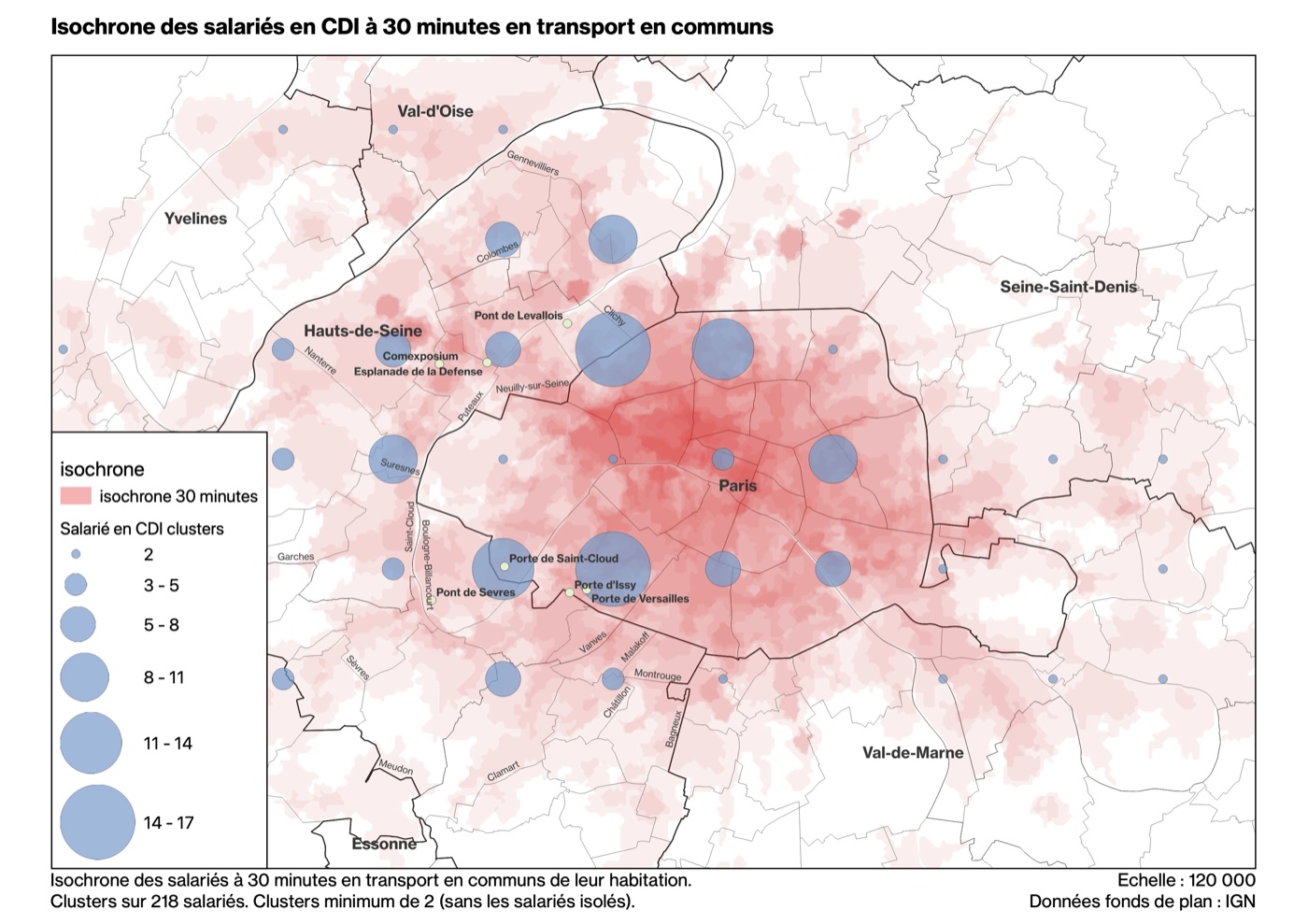
Geospatial analysis to support the choice of Comexposium's new headquarters. Cross-referencing employee addresses with several candidate sites to calculate and compare commute times, prioritising public transport and soft mobility over car use.
Update of INSEE geographic and demographic reference data. Creation of a multi-country dataset and automation of internal processes.

Mobsuccess is a French company specialising in geolocated digital marketing, combining media, data and artificial intelligence.
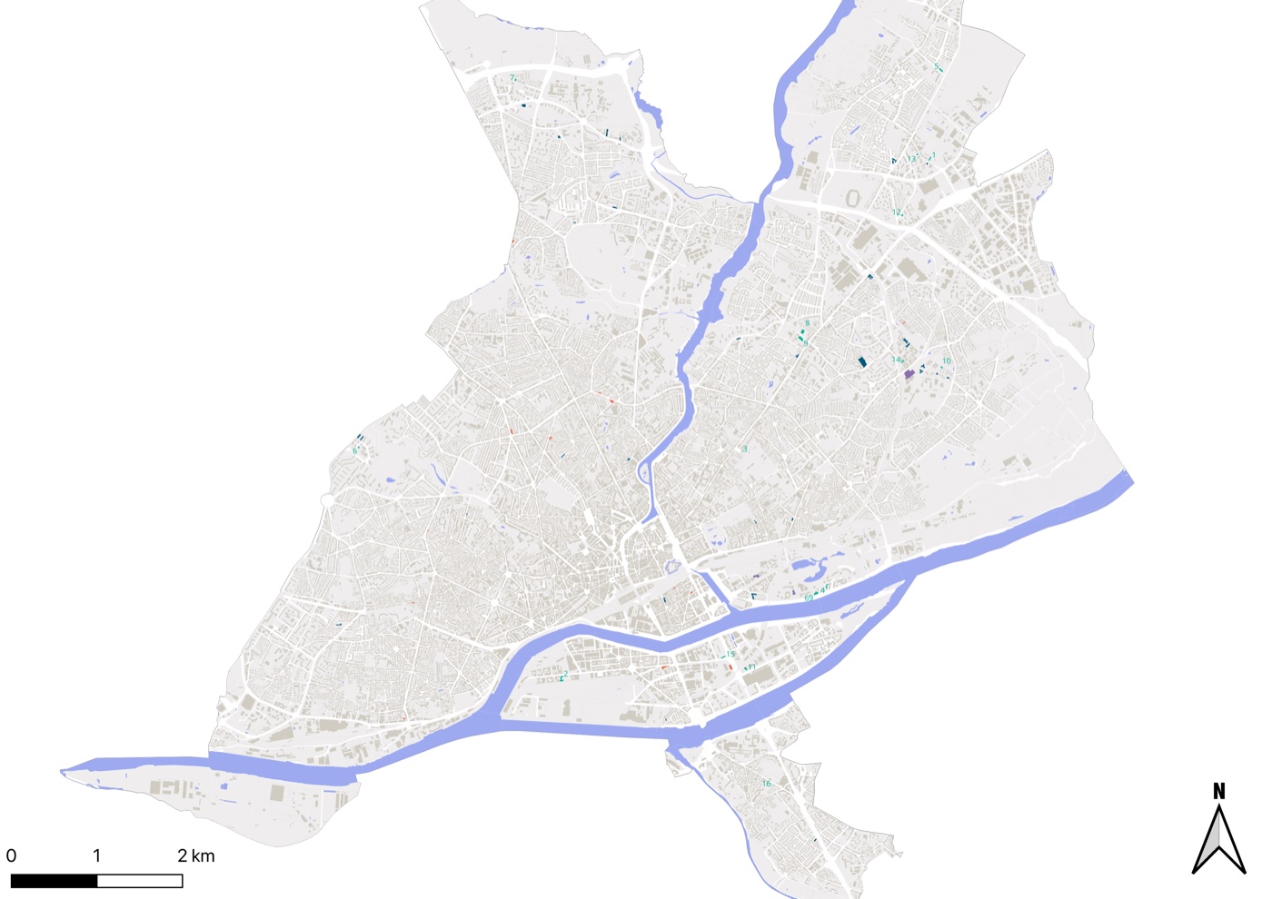
Creation of catchment areas and penetration rate analysis for retail brands including Décathlon, Gémo and Gifi.
Update of INSEE geographic and demographic reference data. Creation of a multi-country dataset and automation of internal processes.

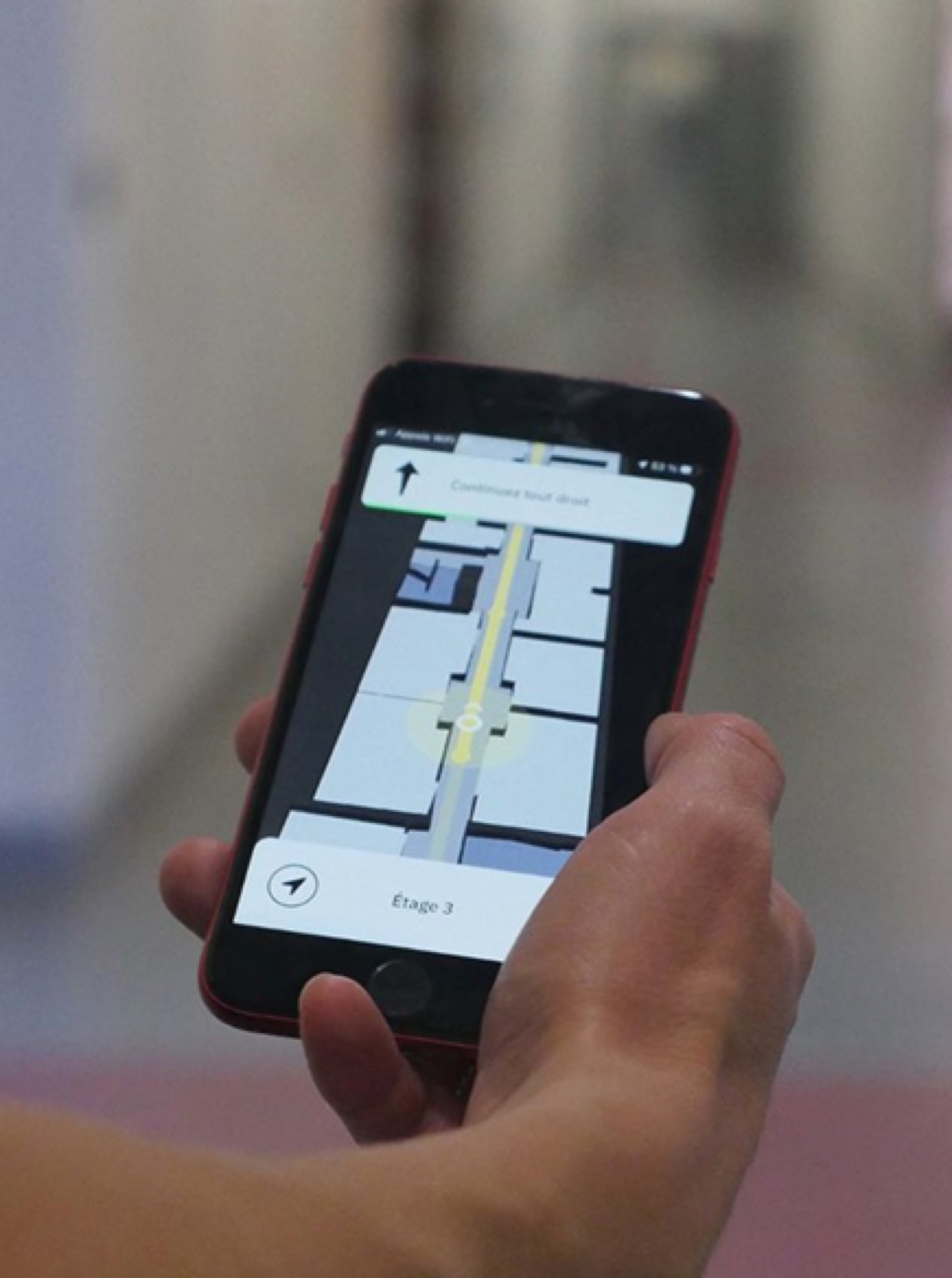
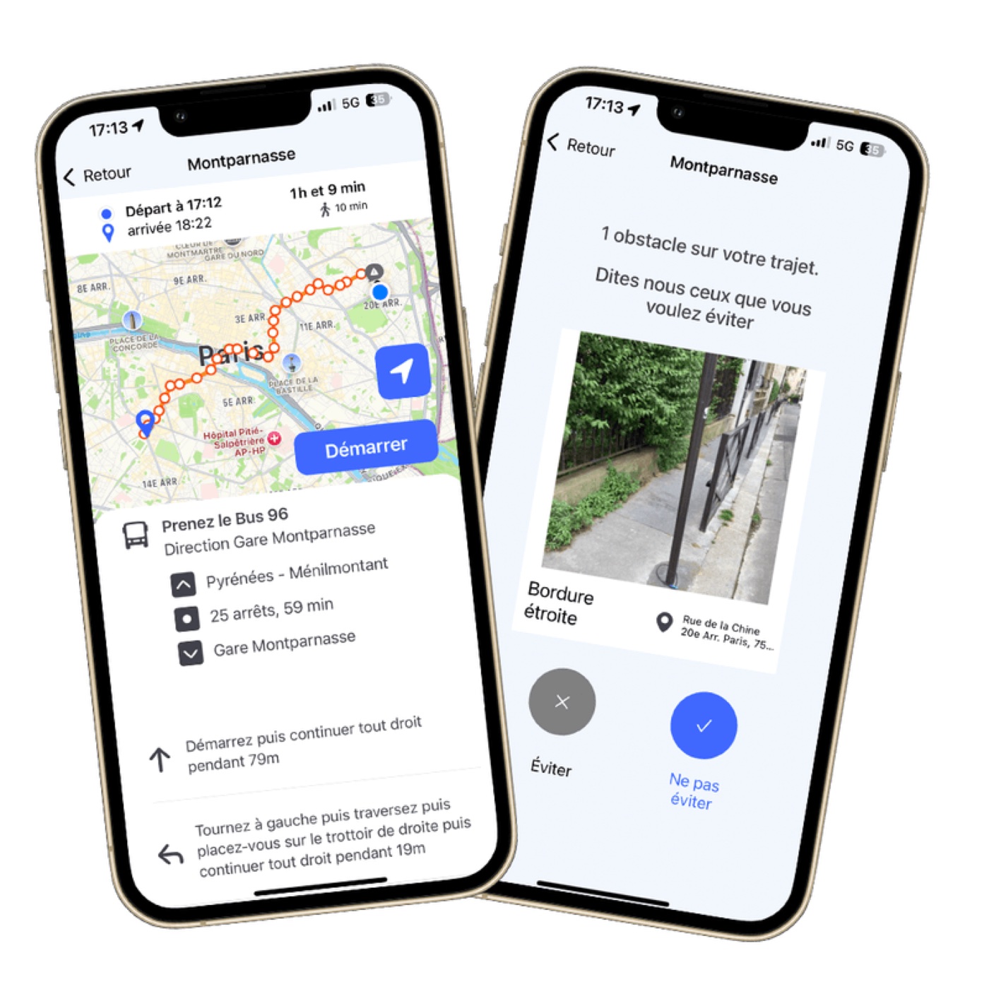
Okeenea is a French company specialising in urban accessibility solutions for people with disabilities.
Creation of custom maps on Mapbox for sites equipped with the Okeenea Digital indoor navigation app.
Data formatting and quality control of geolocated data to ensure reliable navigation in public venues such as museums and metro stations.
SNCF is France's main railway operator, handling passenger and freight transport across the country and Europe.
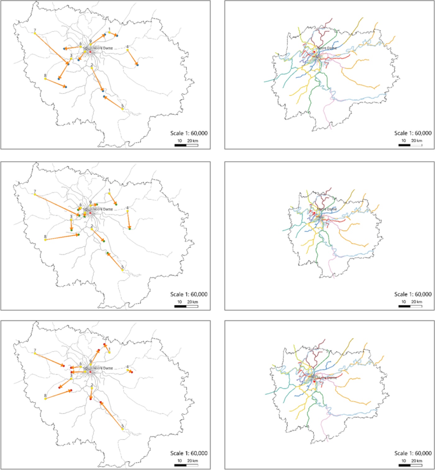
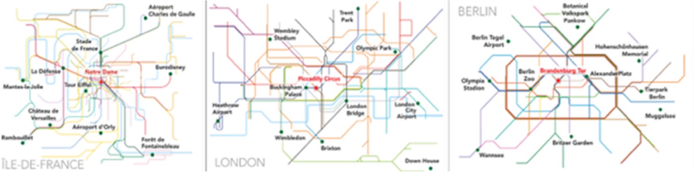
Cartographic research project on the cognitive perception of transport networks.
Using questionnaire data and user feedback, creation of distance cartograms and vector anamorphoses. These maps capture how public transport users and non-users mentally perceive and distort urban space in Paris, Berlin and London. Design of an Île-de-France network map integrating real travel times between stations.
Publication: "Transport makes cities: transit maps as major cognitive frames of metropolitan areas"

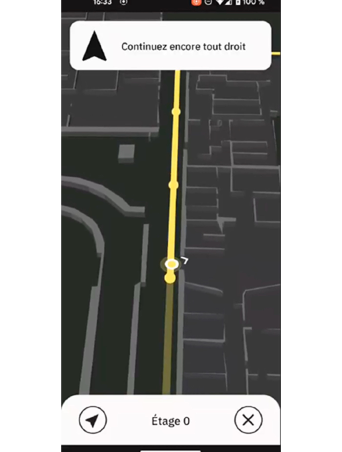
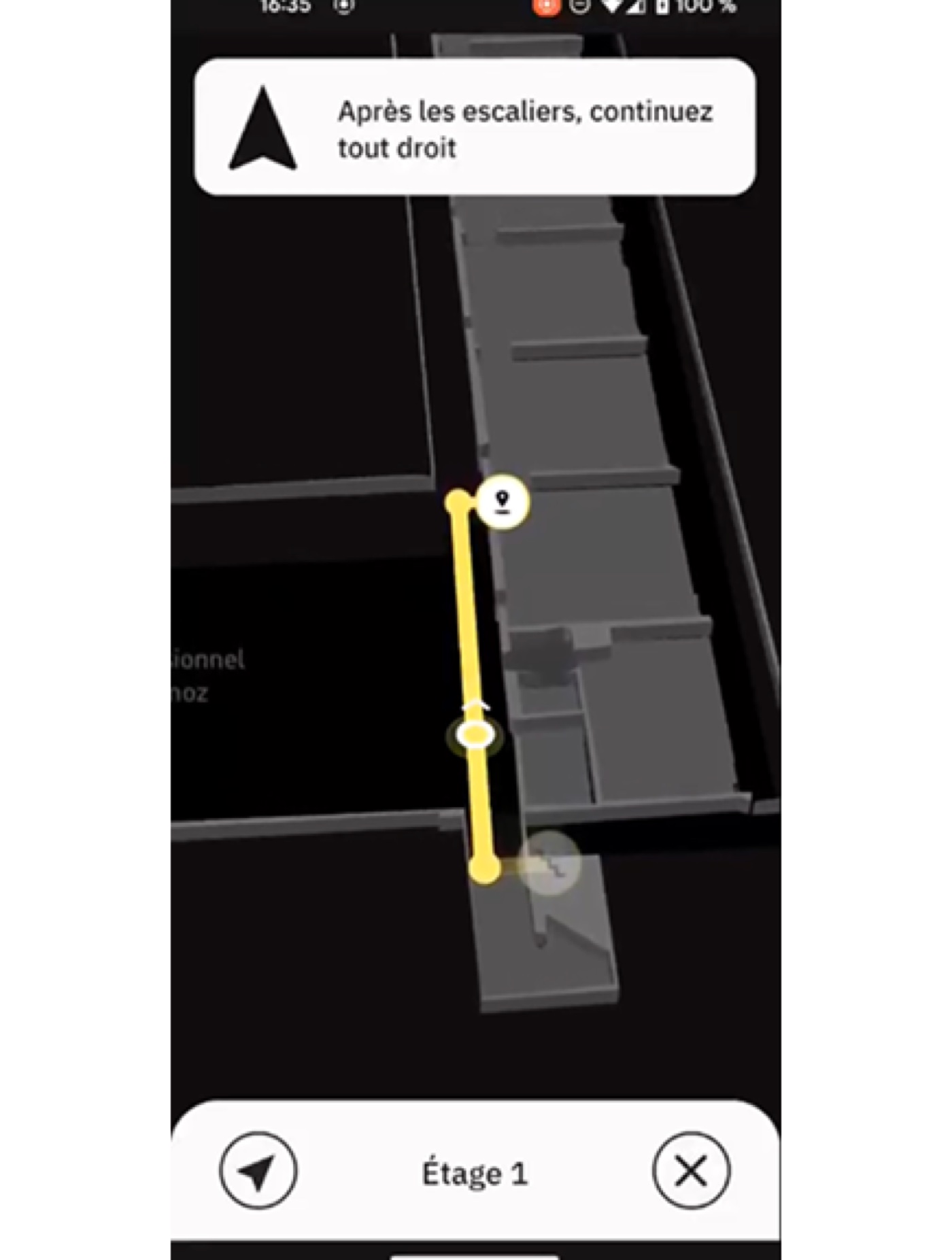
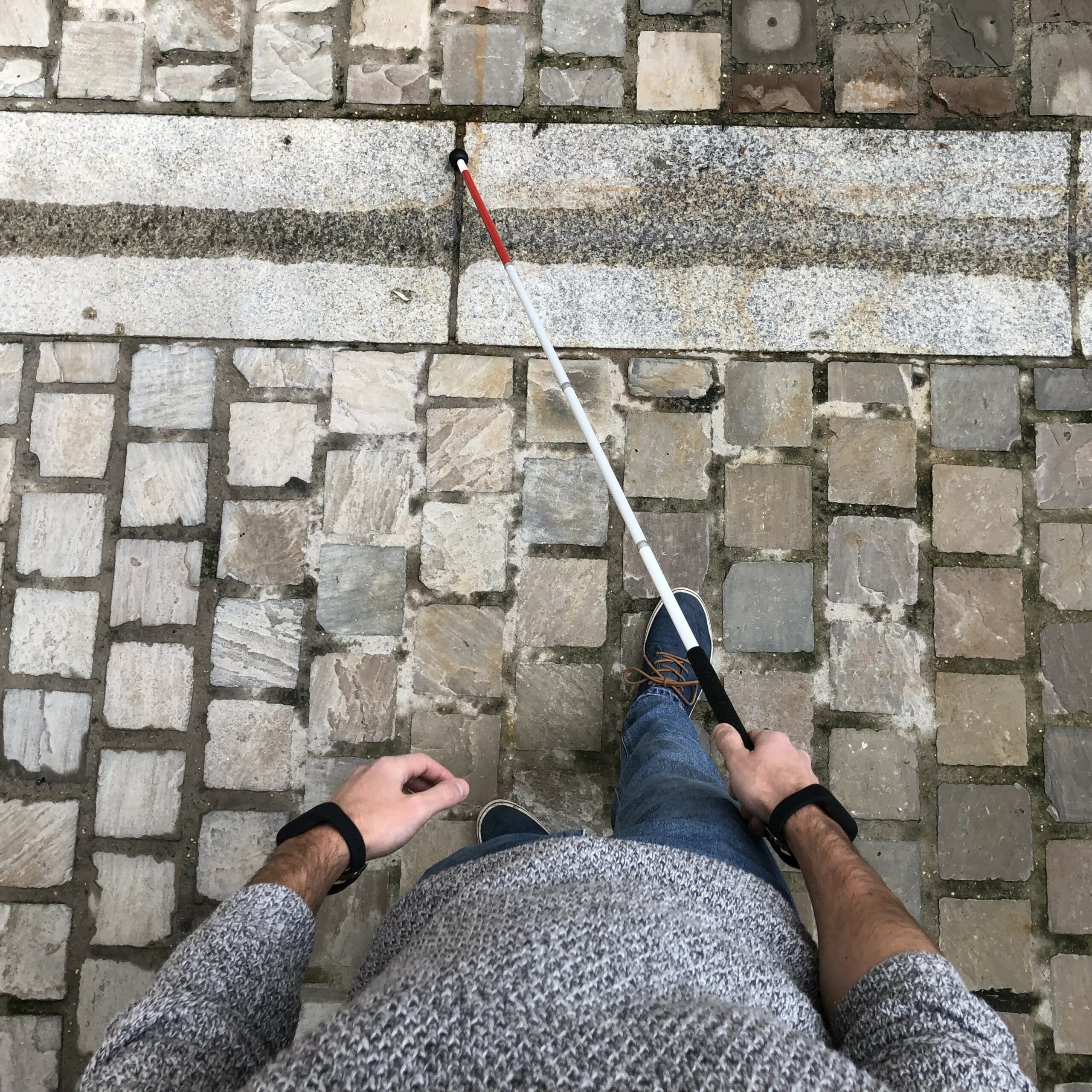
N-Vibe develops a vibrating GPS to guide blind and visually impaired people. The bracelets use vibrations to indicate turns, pedestrian crossings, traffic lights and higher-risk areas.
The mission focused on processing and optimising OpenStreetMap data to feed the navigation engine. Development of scripts to automate data extraction and processing, and query performance optimisation on the database.

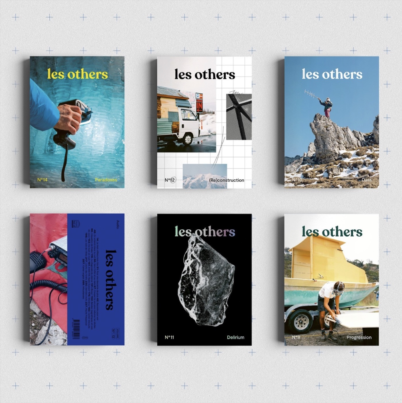
Les Others is an independent media dedicated to adventure and wide open spaces.
Map creation for their Instagram account, respecting a strong visual identity consistent with the media's editorial line.
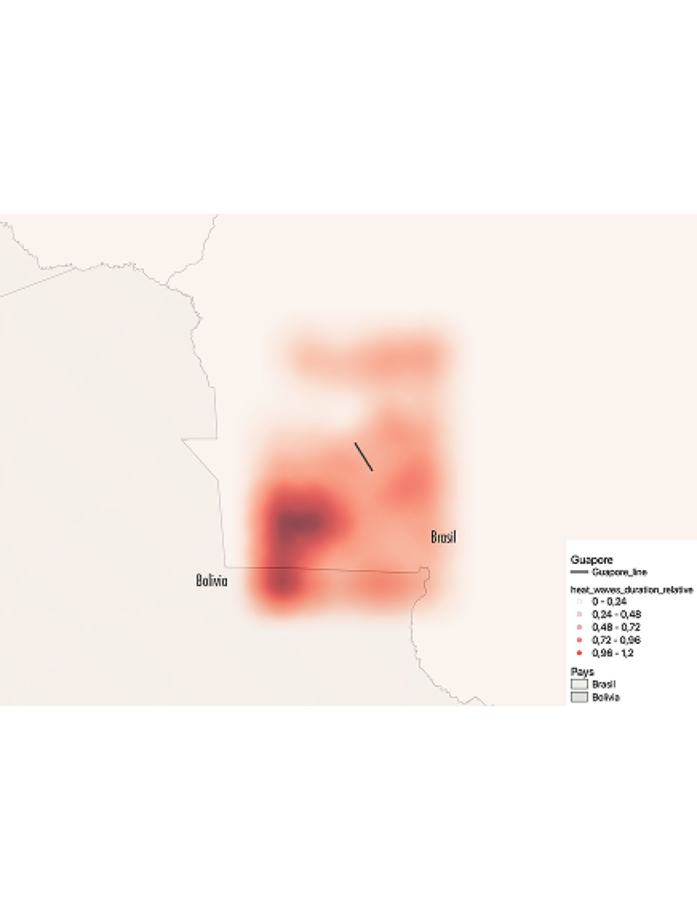
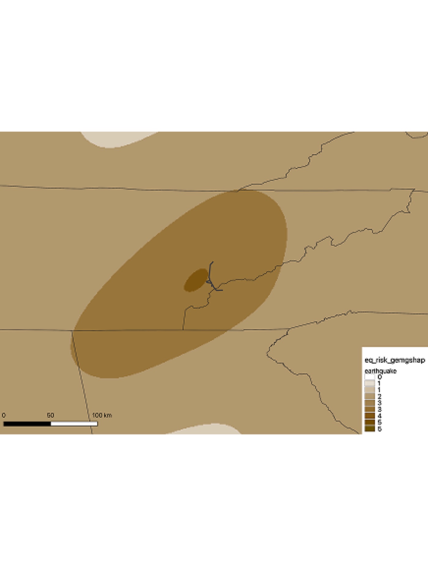
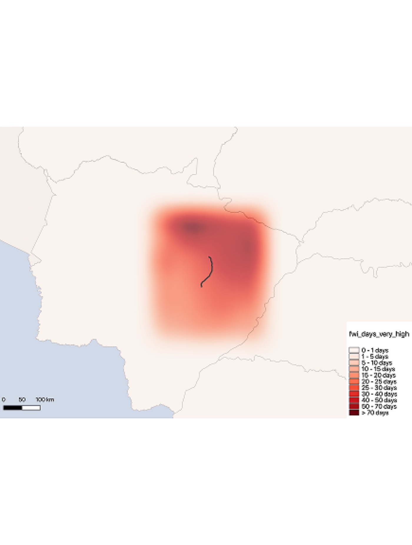
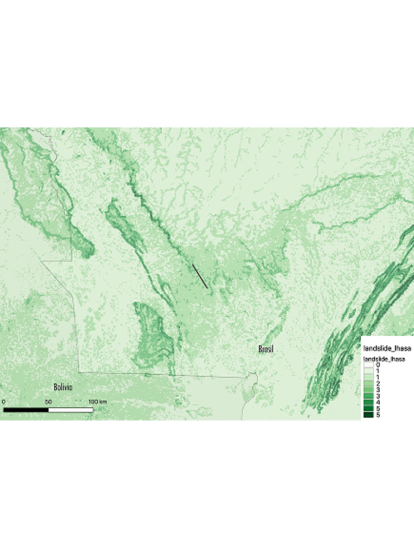
AXA Climate is AXA's branch specialising in climate risk analysis and management for businesses.
Current and future climate analyses to assess climate change risks on infrastructure projects worldwide.
Indicators covered: extreme temperatures, heavy rainfall, extreme events (cyclones, seismic risks, wildfires), water stress and sea level rise. For projects built to last, even under the most challenging climate scenarios.

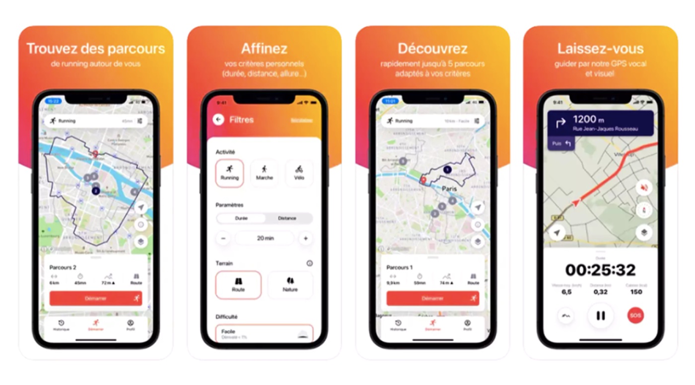
MyJungly is a digital studio specialising in UI/UX design, integration and development.
Contribution to the geospatial engine for running route calculation. OpenStreetMap data processing, GraphHopper/OpenRouteService configuration and PostGIS query optimisation to generate routes based on user constraints: closed loop, defined distance, surface type and proximity to natural spaces.
Runnrz generates custom routes in 3 seconds based on selected personal criteria.

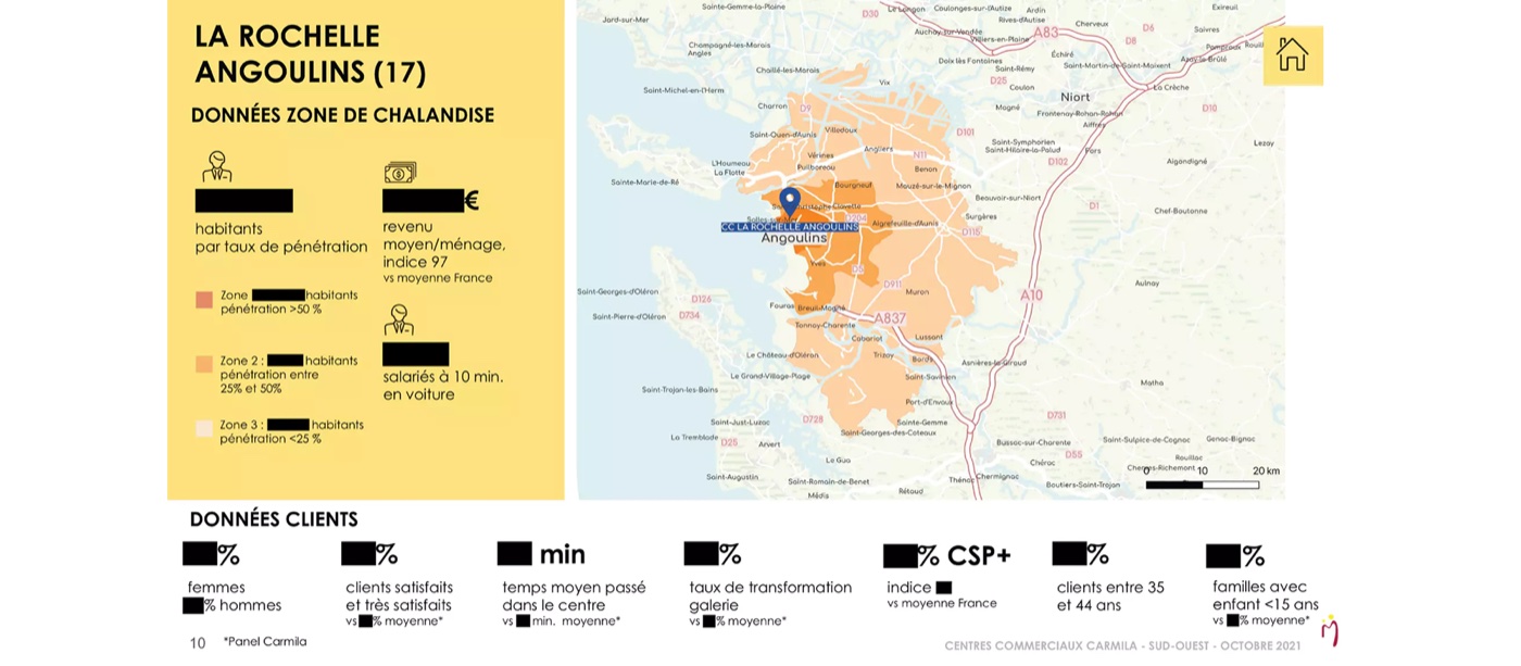
Carmila specialises in the management and development of retail centres attached to Carrefour hypermarkets across Europe.
Production of over a hundred maps covering all of the group's retail centres: penetration rates, isochrone zones and catchment areas.
These maps were integrated into their Assets Book and presented at the Paris Retail Week trade show.